search
Best Time to Climb Mount Elgon in Uganda

Best Time to Climb Mount Elgon in Uganda

By Travel stories and blogs, Adventure holidays, Uganda travel guides

Best Time to Climb Mount Elgon in Uganda

The Ancient Giant of Uganda

In the eastern reaches of Uganda, on the border with Kenya, rises a mountain so ancient that time itself has softened its rugged edges into gentle slopes and wide moorlands. This is Mount Elgon, a dormant volcanic giant whose massive caldera remains among the largest in the world. Though less celebrated than Kilimanjaro or Mount Kenya, Mount Elgon offers one of the most captivating trekking experiences in East Africa, blending dramatic landscapes, rich biodiversity, and deep cultural significance.

Climbing Mount Elgon is not merely a physical endeavor but an immersion into a world where forests echo with birdsong, waterfalls tumble through hidden valleys, and alpine plants bloom against the backdrop of the highlands. Yet the mountain’s rewards can only be fully appreciated when it is climbed at the right time. Seasons shape every moment on Elgon, determining the conditions of the trails, the flow of waterfalls, the richness of vegetation, and even the comfort of evenings spent at camp.

Understanding the best time to climb Mount Elgon is essential for those who wish to maximize the beauty and minimize the challenges of this trek. The mountain does not reveal itself in the same way throughout the year, and timing a climb well can mean the difference between slippery trails cloaked in mist and clear skies that reveal sweeping views across Uganda and into Kenya.

The Geography and Climate of Mount Elgon

To appreciate why timing is so critical, one must first understand the mountain’s geography and climate. Mount Elgon rises to 4,321 meters above sea level at Wagagai Peak, yet its base spreads across more than 80 kilometers in diameter, making it one of the widest standalone mountains on the continent. Its location near the equator ensures a generally mild climate, but the mountain’s altitude and vast size create significant microclimates.

Rainfall is abundant throughout the year, sustaining lush montane forests, bamboo belts, and moorlands alive with giant lobelias and groundsels. However, rainfall is not evenly distributed. Two primary wet seasons dominate the year: March to May and October to December. During these months, trails become muddier, rivers swell, and daily rains are common, often arriving in the afternoon. The dry seasons, from June to August and December to February, offer more stable weather, clearer skies, and drier trails, though cold temperatures at higher altitudes persist throughout the year.

The interplay between altitude and rainfall produces a spectrum of experiences. Lower slopes remain green and fertile year-round, while higher zones may be more exposed, with fluctuating temperatures and sudden showers even in the dry season. It is this variability that makes the choice of climbing season so critical to a successful and enjoyable trek.

Uganda’s Seasons: A Framework for Climbers

Uganda’s equatorial location ensures a consistent rhythm of rainy and dry periods rather than dramatic shifts between hot and cold. This rhythm dictates the ease of climbing Mount Elgon and the type of experience one can expect.

The long rainy season, stretching from March through May, is characterized by heavy downpours that often occur in the afternoons and evenings. Rivers and waterfalls swell, forests become saturated with life, and trails grow slippery. While the scenery is vibrant and lush, trekking is physically demanding during these months.

The short dry season, typically from June through August, brings more stable conditions. Rain is less frequent, skies are clearer, and trails are more manageable. This is one of the most favorable windows for climbing Mount Elgon.

The short rainy season, from October to December, mirrors the long rains but with slightly less intensity. Showers are frequent, yet interspersed with clear skies. For those who do not mind occasional rain, this period offers fewer crowds and equally rich landscapes.

Finally, the long dry season, from December to February, is arguably the best time to climb the mountain. Days are sunnier, evenings are crisp, and the reduced rainfall ensures better conditions for both trekking and camping.Best Time to Climb Mount Elgon in Uganda

The Long Rainy Season: March to May

Climbing Mount Elgon during the long rainy season is a test of resilience. The mountain receives some of its heaviest rainfall during these months, often in the form of powerful afternoon storms. The trails become muddy, streams swell into rivers, and the challenge of hiking is compounded by slippery conditions.

Yet there are rewards. The waterfalls of Mount Elgon, including the famous Sipi Falls near its foothills, are at their most dramatic, tumbling with immense power from the cliffs. Vegetation flourishes, forests are alive with vibrant green foliage, and birdlife is abundant. For those who seek solitude, this season also ensures fewer trekkers, granting a sense of exclusivity on the trails.

However, the risks must be considered carefully. Campgrounds may become waterlogged, gear must be meticulously waterproofed, and daily progress is often slowed by conditions underfoot. For experienced trekkers who value solitude and the raw force of nature, this season holds appeal, but for most, it is not the most practical choice.

The Short Dry Season: June to August

By June, the rains subside, ushering in one of the most favorable times to climb Mount Elgon. The short dry season is characterized by clearer skies, reduced rainfall, and more comfortable trekking conditions. Trails dry out, making ascents less strenuous, while rivers and streams return to manageable levels.

This period is ideal for those who wish to capture sweeping views from the caldera rim, as visibility is often excellent. The cool nights at higher altitudes remain a constant, but the drier weather ensures that campsites are more comfortable and less prone to flooding. The balance between accessibility and natural beauty makes this one of the most popular times for climbers.

Wildlife sightings are also more common, as animals such as duikers, monkeys, and forest hogs are more easily observed along the trails. Birdwatchers delight in the presence of over 300 bird species, many of which are active during this season.

The Short Rainy Season: October to December

The return of the rains in October signals the start of the short rainy season, a period of renewed growth and vitality across Mount Elgon. Though less intense than the long rains, this season still brings challenges for climbers. Afternoon showers are frequent, trails can again become muddy, and the risk of slippery descents increases.

Yet this season has its own charm. The waterfalls regain strength, the landscape grows lush and vibrant, and the cultural communities around the mountain prepare for harvest festivals and rituals. Trekkers who do not mind occasional discomfort are rewarded with fewer crowds and the chance to witness Mount Elgon at its most fertile.

One must, however, prepare diligently. Waterproof gear is essential, and flexibility in scheduling is required to accommodate weather delays. For those seeking an immersive experience of Elgon’s natural abundance, this season holds undeniable allure.

The Long Dry Season: December to February

The long dry season is widely regarded as the best time to climb Mount Elgon. During these months, rainfall is minimal, skies are reliably clear, and conditions across the trails are favorable. The mountain reveals itself in its most accessible form, allowing trekkers to fully appreciate its geological grandeur and ecological diversity.

Climbers who ascend during this season enjoy uninterrupted views from Wagagai Peak, where horizons stretch across Uganda and into Kenya. The caldera is easier to explore, and side attractions such as caves, hot springs, and valleys are more accessible.

Evenings at camp are cold but dry, a welcome contrast to the dampness of the rainy months. Wildlife encounters are frequent, and the cultural experiences in the foothill communities are enhanced by the festive atmosphere that often accompanies the New Year period.

For first-time climbers, this is the recommended season, offering the best balance of comfort, accessibility, and scenic reward.

Other Factors Influencing the Best Time to Climb

While Uganda’s seasons provide the primary framework, other factors also influence the best time to climb Mount Elgon.

Altitude plays a crucial role. Even in the dry season, higher altitudes remain unpredictable, with sudden showers, mist, and cold winds. Nights at elevations above 3,000 meters are consistently cold, regardless of the month.

Trail selection also matters. Routes such as the Sasa Trail involve steeper ascents that become treacherous in wet conditions, while the more gradual Sipi and Piswa trails are manageable even with occasional rain. Climbers must therefore consider both season and route when planning.

Personal preference further shapes the decision. Some may prioritize clear skies and comfort, making the long dry season ideal. Others may seek solitude, lush vegetation, or powerful waterfalls, leading them to the rainy seasons despite the challenges.

Month-by-Month Breakdown

A closer look at each month provides a more precise understanding of what to expect:

January and February mark the heart of the long dry season. These months are the most favorable for climbing, with reliable weather, excellent visibility, and comfortable trail conditions.

March, April, and May bring the heaviest rains. Trails are muddy, but waterfalls are spectacular, and the landscape is at its greenest. These months are best suited for adventurous trekkers seeking solitude.

June, July, and August offer a respite from the rains. Conditions are stable, skies are clear, and climbing is enjoyable. This is the second-best window after December–February.

September often begins dry but transitions into wetter conditions by the end of the month, requiring flexibility for those planning climbs.

October, November, and December bring the short rains. Conditions are variable, but the landscape is vibrant. December often transitions back into the dry season, making late December a favorable time.

The Rewards of Perfect Timing

When climbed in the right season, Mount Elgon reveals its full majesty. Trails lead smoothly through montane forests alive with colobus monkeys, into bamboo zones echoing with bird calls, and onward to moorlands adorned with giant lobelias. The caldera’s vastness stretches endlessly, a silent reminder of the mountain’s volcanic past.

Perfect timing allows trekkers to enjoy these wonders without the frustrations of waterlogged gear, impassable paths, or obscured views. It enhances the cultural experience as well, with communities more accessible and festivals more frequent during dry months. Above all, it allows the climber to focus not on the struggle against weather but on the profound beauty of the journey itself.

Choosing the Right Season for Mount Elgon

Mount Elgon is more than a climb; it is a living landscape where geology, ecology, and culture converge in breathtaking harmony. To walk its trails is to step into an ancient story, one that has been unfolding for millions of years. Yet this story is best read at the right moment, when the mountain opens itself fully to those who seek its summit.

For most climbers, the long dry season from December to February offers the most favorable conditions, while the short dry season from June to August provides an excellent alternative. These periods combine clear skies, stable trails, and cultural vibrancy, ensuring that every step on Elgon is as rewarding as the summit itself.

For those ready to embark on this unforgettable journey, it is recommended to book tours and safaris through WildHorn Africa, a trusted guide to Uganda’s treasures. With their expertise, every climb is transformed into a seamless adventure, filled with discovery, reflection, and memories that endure long after the descent.

Mount Elgon vs Rwenzori: Which Trekking Adventure to Choose?

Mount Elgon vs Rwenzori: Which Trekking Adventure to Choose?

By Travel stories and blogs, Adventure holidays, Uganda travel guides

Mount Elgon vs Rwenzori: Which Trekking Adventure to Choose?

The Call of Uganda’s Mountains

Uganda, often celebrated as the “Pearl of Africa,” is a land where mountains rise majestically over lush valleys, lakes glisten under equatorial sunshine, and wildlife roams in unspoiled habitats. Among its most dramatic natural wonders stand Mount Elgon in the east and the Rwenzori Mountains in the west. Both present world-class trekking opportunities, each offering unique landscapes, ecosystems, and cultural encounters. For adventurers planning their next great climb, the question often arises: Mount Elgon or Rwenzori—which trekking adventure should be chosen?

To answer this, one must go beyond the surface and explore the deeper contrasts. Mount Elgon, with its ancient volcanic caldera, promises a gentler trek filled with biodiversity and cultural immersion. The Rwenzori Mountains, also known as the “Mountains of the Moon,” challenge trekkers with rugged alpine climbs, glaciers, and dramatic peaks. Both are UNESCO-listed treasures and both embody the essence of Uganda’s natural splendor, yet they differ in character, difficulty, and experience.

This guide delves into the landscapes, climate, wildlife, culture, trekking routes, and practical considerations of each mountain, offering a rich and structured comparison to help travelers decide which journey calls most strongly to their spirit.

Understanding the Geographic Context

Mount Elgon: The Ancient Volcano of the East

Rising on Uganda’s eastern frontier with Kenya, Mount Elgon is an extinct volcano estimated to be over 24 million years old, making it one of Africa’s oldest highland formations. Once towering higher than Kilimanjaro, erosion has softened its profile, but its immense size remains unmatched—its caldera, stretching over 60 kilometers in diameter, is the largest in the world. The Ugandan side of Mount Elgon lies within Mount Elgon National Park, a sanctuary of forests, caves, waterfalls, and moorlands.

Rwenzori Mountains: The Glaciated Giants of the West

In contrast, the Rwenzori Mountains straddle the border between Uganda and the Democratic Republic of Congo. Unlike Mount Elgon, these are not volcanic in origin but were formed through tectonic uplift. Their peaks, capped with snow and glaciers despite lying near the equator, reach extraordinary heights. Mount Stanley, the highest of the Rwenzori peaks, rises to 5,109 meters, making it Africa’s third-highest mountain after Kilimanjaro and Mount Kenya. Protected as Rwenzori Mountains National Park, this UNESCO World Heritage Site is renowned for its glaciers, alpine meadows, and extraordinary plant life that seems transported from a prehistoric era.

Landscape and Scenery

The Allure of Mount Elgon’s Gentle Slopes

Mount Elgon’s landscape is defined by its caldera, vast moorlands, and cascading waterfalls. Its slopes are carpeted with montane forests, home to bamboo thickets, olive trees, and dense vegetation where primates swing between branches. Ascending higher, the scenery transforms into heath and moorland zones, adorned with giant groundsels and lobelias. At the caldera rim, trekkers are rewarded with panoramic views across Uganda and Kenya, a reminder of the mountain’s once fiery geological past.

The highlight of Mount Elgon is not just reaching a peak but the journey through its diverse habitats. With multiple waterfalls such as Sipi Falls on its foothills, caves formed by lava flows, and vast highland plains, the mountain offers a scenic variety unmatched by many ranges.

The Dramatic Drama of the Rwenzori Range

The Rwenzori landscape is altogether more dramatic. As one ascends, dense tropical rainforests give way to mist-covered bamboo forests, moss-laden heather zones, and finally to surreal alpine meadows filled with giant groundsels and lobelias rising like sentinels. Above these zones lies the ultimate prize: the glaciated peaks of Mount Stanley, Mount Speke, and Mount Baker, their snowfields gleaming under the equatorial sun.

Unlike Elgon’s gentler slopes, the Rwenzoris are steep and rugged, with deep valleys carved by glacial streams. Their atmosphere is otherworldly—often shrouded in mist, with looming cliffs and frozen lakes creating a sense of remote wilderness that feels untouched by time.

Climate and Trekking Seasons

Mount Elgon’s Temperate Climates

Due to its relatively lower altitude, Mount Elgon experiences a milder climate compared to the Rwenzoris. Temperatures on the slopes average between 15°C and 23°C, with nights cooling significantly at higher elevations. Rainfall is distributed across the year, though the dry seasons from June to August and December to February offer the best trekking conditions. Trails remain navigable, and the surrounding landscapes, whether verdant or sunlit, enhance the trekking experience.Mount Elgon vs Rwenzori: Which Trekking Adventure to Choose?

Rwenzori’s Harsh but Rewarding Conditions

Trekking the Rwenzoris, however, requires preparation for harsher conditions. Temperatures vary greatly depending on altitude, dropping below freezing at higher elevations where glaciers dominate. Rainfall is frequent, as the range captures moisture from the Congo Basin, creating wet conditions almost year-round. The drier months of June to August and December to February provide more favorable trekking conditions, but trekkers must still be prepared for mud, snow, and fog.

This challenging climate is part of the Rwenzori’s mystique. The struggle against weather and terrain makes the eventual sight of glaciers or peaks deeply rewarding.

Trekking Routes and Difficulty

Trekking Mount Elgon: Accessible and Diverse

Mount Elgon’s treks are considered more accessible, making them ideal for both novice trekkers and seasoned adventurers. Popular routes include the Sasa Trail, which provides a direct though steep ascent, the Sipi Trail, which is longer but more gradual, and the Piswa Trail, known for its scenic views. Treks typically last from three to seven days depending on the route and chosen pace.

The highest point, Wagagai Peak at 4,321 meters, is attainable without technical climbing equipment. The altitude, while significant, rarely induces severe mountain sickness, and the trails are less demanding compared to other African peaks. This makes Mount Elgon particularly appealing to those seeking a rewarding mountain trek without extreme difficulty.

Trekking the Rwenzori: A Test of Endurance

In contrast, the Rwenzori Mountains demand endurance, resilience, and technical ability. The most famous trek, the Central Circuit, takes about seven to nine days, leading climbers through diverse vegetation zones to the peaks. The Kilembe Trail is another route, offering longer treks with scenic variations.

Climbing Mount Stanley’s Margherita Peak requires technical equipment such as ropes, crampons, and ice axes, as trekkers must cross glaciers and navigate steep ascents. The challenges of mud, altitude, and cold add to the difficulty, making the Rwenzori trek suitable only for those with good fitness and determination. Yet, it is precisely these hardships that make the experience legendary.

Wildlife and Biodiversity

Mount Elgon’s Rich Ecosystems

Mount Elgon National Park is a biodiversity hotspot, hosting over 300 bird species, including the endangered lammergeyer. Its forests shelter primates such as colobus monkeys and blue monkeys, while antelopes, forest elephants, and buffaloes roam its slopes. The caves within the park are frequented by elephants mining for salt, a rare behavior that fascinates scientists and visitors alike.

The mountain’s varied vegetation zones, from montane forests to moorlands, sustain an extraordinary array of flora and fauna. For nature enthusiasts, trekking Mount Elgon offers not only mountain views but also abundant encounters with wildlife and birdlife.

Rwenzori’s Unique Alpine Species

The Rwenzori Mountains also boast incredible biodiversity, though adapted to harsher alpine environments. The lower slopes are home to chimpanzees, L’Hoest’s monkeys, and forest elephants, while higher zones showcase the surreal botanical giants for which the range is famous. Plants such as giant lobelias and groundsels create landscapes that resemble prehistoric gardens.

Birdlife thrives here too, with over 200 recorded species, many endemic to the Albertine Rift. The combination of unique flora and fauna with the dramatic terrain makes the Rwenzoris one of the most distinctive ecosystems on the continent.

Cultural Encounters

Mount Elgon’s Bagisu and Sabiny Traditions

The cultural dimension of trekking Mount Elgon is profound. The mountain is home to the Bagisu and Sabiny peoples, whose traditions and lifestyles enrich the trekking experience. The Bagisu, also known as the Bamasaba, are famed for their Imbalu circumcision ceremonies, which symbolize the transition of boys into manhood. Visitors trekking during these ceremonies often witness colorful rituals filled with song, dance, and communal celebration.

Coffee farming also thrives on Elgon’s slopes, with Arabica beans cultivated in fertile volcanic soils. Coffee tours complement trekking, offering insights into agricultural practices and community livelihoods. These cultural immersions deepen the sense of connection between visitors and the mountain’s people.

Rwenzori’s Bakonzo and Their Mountain Heritage

The Rwenzori Mountains are home to the Bakonzo people, who have long held the peaks as sacred. Their traditions, songs, and oral histories reflect a profound connection to the mountains, which are seen as abodes of spirits. Many local guides hail from Bakonzo communities, and their knowledge of the terrain is indispensable for trekkers.

Engaging with the Bakonzo offers not only logistical support but also cultural enrichment, as their stories and practices contextualize the mystical aura of the Rwenzoris.

Accessibility and Logistics

Mount Elgon: Easier to Reach

Mount Elgon’s accessibility is a strong advantage. Located about 235 kilometers from Kampala, Uganda’s capital, it can be reached in roughly five to six hours by road. The town of Mbale serves as a base, with nearby Sipi Falls providing accommodation and pre-trek acclimatization opportunities. Permits and guides can be arranged locally, and the park infrastructure supports trekking with well-maintained trails and campsites.

Rwenzori: Remote but Rewarding

Reaching the Rwenzori Mountains requires a longer journey, about 400 kilometers from Kampala to Kasese or Kilembe, taking roughly eight to ten hours by road. The remoteness adds to the sense of adventure but requires greater planning. Permits, technical equipment, and experienced guides are essential, particularly for those aiming to summit Margherita Peak. Despite the logistical demands, the reward of standing amid the equatorial glaciers is beyond compare.

Choosing Between Mount Elgon and Rwenzori

Deciding between Mount Elgon and the Rwenzori Mountains ultimately depends on personal goals, fitness levels, and desired experiences.

Mount Elgon offers accessibility, moderate trekking difficulty, rich biodiversity, and deep cultural immersion. It suits those who wish to enjoy mountain trekking without extreme physical demands, while still experiencing breathtaking landscapes and wildlife.

The Rwenzori Mountains cater to the adventurous spirit seeking a challenging expedition. With glaciers, high peaks, and otherworldly landscapes, they provide one of the most demanding yet rewarding trekking experiences in Africa. This trek is for those prepared to endure hardships in pursuit of standing on Africa’s third-highest summit.

Two Mountains, One Choice of Spirit

Mount Elgon and the Rwenzori Mountains stand as Uganda’s twin guardians of adventure, each with a unique voice. Elgon whispers with gentleness, inviting trekkers to explore vast calderas, waterfalls, and cultural rhythms. The Rwenzori roars with drama, testing endurance with glaciers and steep ascents in an untamed wilderness.

To choose between them is not merely to select a destination but to align with a personal spirit of adventure. Whether the choice falls upon Elgon’s accessible beauty or Rwenzori’s formidable grandeur, the experience will leave indelible memories of Uganda’s mountains.

For travelers seeking to transform choice into experience, it is recommended to arrange treks through WildHorn Africa, a trusted specialist in African safaris and mountain expeditions. With expert planning, cultural connections, and deep knowledge of Uganda’s landscapes, WildHorn Africa ensures that the journey—whether on Elgon’s slopes or Rwenzori’s peaks—becomes not just a trek but a life-defining adventure.

Mount Elgon Hiking Itinerary Ideas

Mount Elgon Hiking Itinerary Ideas

By Travel stories and blogs, Adventure holidays, Family holidays, Uganda travel guides

Mount Elgon Hiking Itinerary Ideas

Charting a Journey through Uganda’s Ancient Giant

Rising majestically along the Uganda-Kenya border, Mount Elgon is an ancient volcanic massif that captures the imagination of adventurers, nature enthusiasts, and cultural explorers alike. Unlike many of Africa’s iconic mountains, Mount Elgon is characterized not by sheer verticality but by its vast caldera, expansive slopes, deep gorges, and mist-laden forests, making it uniquely accessible yet profoundly rewarding. Hiking this colossal landscape is more than a physical challenge—it is a journey into the heart of Uganda’s ecological diversity, cultural richness, and geological history.

Planning a hiking itinerary on Mount Elgon involves balancing ambition with realism, considering trail difficulty, accommodation, weather, and the desire to immerse oneself fully in the mountain’s natural and cultural wonders. Each trail provides a distinct experience, from the cascading waters of Sipi Falls to the subterranean mysteries of Kitum Cave. This article explores detailed itinerary ideas, offering guidance on routes, daily schedules, and activities, ensuring that visitors can craft a journey that is both safe and unforgettable.

Understanding Mount Elgon’s Trails and Terrain

The Topography of Mount Elgon

Mount Elgon’s terrain is diverse, with elevations ranging from approximately 1,100 meters at the foothills to over 4,321 meters at Wagagai Peak, the highest point on the Ugandan side. The mountain features steep ridges, gentle slopes, rolling moorlands, bamboo forests, and montane forests. Watercourses carve deep valleys, and caves formed from volcanic activity dot the landscape.

Understanding this diversity is crucial for designing itineraries. Hikes vary from short day treks to multi-day summit climbs. Each trail has distinct challenges, including changes in altitude, variable weather conditions, and the physical demands of hiking through forests, moorlands, and bamboo belts. It is recommended that hikers assess their fitness level, acclimatize gradually, and engage experienced local guides.

Main Hiking Trails

Mount Elgon offers several well-established routes. Among the most popular are the Sasa, Piswa, Kapkwai, and Suam trails, each with unique features. The Sasa Trail, beginning at Budadiri, is the steepest and shortest route to the summit, suitable for hikers seeking a challenging ascent. The Piswa Trail, starting near Kapchorwa, is longer but less strenuous, offering gradual elevation gain and expansive views of the Karamoja plains. Kapkwai and Suam trails traverse the eastern and northern slopes, passing through bamboo forests, waterfalls, and caves, making them ideal for hikers who wish to combine nature and adventure.

One-Day Hiking Itineraries

Day Hikes to Sipi Falls

For travelers constrained by time, day hikes from Sipi Falls lodges provide immersive experiences without the need for overnight trekking. A typical itinerary involves an early morning departure from the lodge, followed by a guided hike to the three tiers of Sipi Falls. The trails wind through farmland, forest patches, and coffee plantations, offering views of the surrounding Elgon foothills.

Upon reaching the falls, hikers can explore natural pools, photograph the cascading waters, and observe bird species inhabiting the area. Returning to the lodge in the afternoon allows time for relaxation, coffee tasting experiences, and interaction with local communities. This day itinerary offers both adventure and cultural engagement, providing a fulfilling glimpse of the mountain’s diversity.

Exploring Kitum Cave

Another feasible one-day itinerary is a guided walk to Kitum Cave, renowned for its ecological and geological significance. The cave is famous for the elephants that enter to mine salt from its walls—a rare behavior observed in few locations worldwide. Hikers can traverse the forested paths, observe wildlife tracks, and explore the cave under the supervision of experienced guides. Returning to a nearby lodge completes a day of adventure, blending geological curiosity with ecological observation.

Two-Day Itineraries: Moderate Trekking Adventures

Sasa Trail Overnight Hike

A two-day itinerary along the Sasa Trail is ideal for hikers seeking moderate adventure. Day one begins with an early ascent from Budadiri, passing through cultivated landscapes, bamboo belts, and forested sections. The trail gradually steepens as hikers approach higher altitudes, offering panoramic views of the surrounding valleys and distant plains.

Accommodation is arranged at a base camp or mountain hut along the trail, where hikers can rest, enjoy a warm meal, and prepare for the summit attempt the following day. The second day involves a pre-dawn climb to Wagagai Peak, allowing hikers to witness sunrise over the caldera—a breathtaking reward for the effort. The descent is gradual, retracing the trail to Budadiri, concluding a two-day experience that combines challenge, scenery, and a deep sense of achievement.Mount Elgon Hiking Itinerary Ideas

Kapkwai Trail Overnight Trek

The Kapkwai Trail offers a less steep but longer alternative, suitable for hikers who prefer gradual elevation gain. The first day involves trekking through bamboo forests and montane vegetation, encountering streams, waterfalls, and birdlife. Evening accommodation can be arranged at a community campsite or eco-lodge, providing interaction with local residents and cultural immersion.

The second day focuses on reaching viewpoints overlooking the caldera and surrounding highlands, offering photographic opportunities and wildlife observation. Descending back to Kapkwai concludes a journey that emphasizes both natural beauty and cultural experience, demonstrating the versatility of Mount Elgon’s trails for moderate hikers.

Three-Day Itineraries: Summit Experiences

Multi-Day Summit via Piswa Trail

For those seeking a summit experience, a three-day itinerary along the Piswa Trail provides a comprehensive adventure. Day one begins with a drive from Mbale or Kapchorwa to the trailhead, followed by trekking through farmland and bamboo belts to an overnight camp at a mid-altitude location. Evening activities include orientation on summit strategies, ecological briefings, and a cultural exchange with local guides.

Day two involves continued ascent through montane forests and moorlands, passing endemic flora and unique fauna. The evening is spent at a higher camp, preparing for the summit push. Day three begins with a pre-dawn climb to Wagagai Peak, where hikers are rewarded with sweeping views of the caldera, neighboring highlands, and distant Kenyan landscapes. Descending through bamboo forests and moorlands, hikers return to trailhead transportation, completing a journey that blends endurance, natural beauty, and accomplishment.

Integrating Waterfall Exploration

Three-day itineraries can be diversified to include visits to Sipi Falls or Kapkwai Falls en route to higher altitudes. This integration allows hikers to experience the park’s aquatic landscapes alongside summit trekking. Guides provide ecological insights, explaining the importance of waterfalls in maintaining biodiversity, water regulation, and local livelihoods. Overnight stays in eco-lodges near waterfalls enrich the itinerary, offering comfort and immersion in natural surroundings.

Four- to Five-Day Itineraries: Extended Exploration

Comprehensive Circuit Hikes

Extended itineraries of four to five days allow hikers to explore multiple trails, ecological zones, and cultural sites. For example, a circuit incorporating the Sasa, Kapkwai, and Piswa Trails enables hikers to traverse bamboo forests, montane zones, moorlands, and valleys, observing diverse flora and fauna along the way. Campsites and eco-lodges provide structured rest points, meals, and interaction with local communities.

Extended hikes also provide opportunities for photography, birdwatching, and wildlife observation, as travelers can spend additional time in specific ecological zones, observing elephants, monkeys, and rare bird species. These itineraries appeal to serious hikers, naturalists, and those seeking a profound connection with Mount Elgon’s landscapes.

Cultural Integration on Extended Treks

Longer hikes facilitate engagement with communities along the mountain slopes, including visits to Bagisu and Sabiny villages. Hikers may participate in coffee farm activities, craft demonstrations, and traditional ceremonies, gaining insights into daily life and local customs. These interactions enrich the hiking experience, transforming it from a purely natural adventure into a cultural and ecological journey.

Considerations for Planning Hiking Itineraries

Fitness and Acclimatization

Given the altitudinal variation of Mount Elgon, hikers are advised to assess physical readiness and consider gradual acclimatization. Trails such as Piswa provide gradual elevation gain, suitable for multi-day treks, while Sasa offers a steeper ascent requiring higher fitness levels. Rest periods, hydration, and moderate pacing are essential for safe and enjoyable hiking.

Seasonal Timing

The dry seasons from June to August and December to February offer optimal hiking conditions, with clear trails, accessible campsites, and better wildlife visibility. Rainy seasons can render trails slippery, increase water levels in streams, and make some areas inaccessible. Planning itineraries according to seasonal conditions ensures safety and enhances the overall experience.

Guiding and Logistics

Engaging experienced local guides is strongly recommended. Guides provide ecological knowledge, trail navigation, and safety oversight, enriching the hike with insights into flora, fauna, and cultural practices. Logistics including porters, meals, camping equipment, and transportation are often coordinated through lodges or tour operators, ensuring a seamless hiking experience.

Integrating Lodges and Camps

Luxury and eco-lodges along Mount Elgon complement hiking itineraries by providing comfort, meals, and rest points. Lodges near Sipi Falls, Kapchorwa, and Mbale offer access to trails while allowing for recovery, spa treatments, and cultural interactions. Camping sites along trails provide immersive wilderness experiences, balancing rustic adventure with guided support. Combining lodge stays with trail camping creates a dynamic and flexible itinerary, tailored to diverse traveler preferences.

Crafting a Meaningful Hiking Experience

Mount Elgon offers an unparalleled combination of adventure, natural beauty, and cultural immersion. Its trails accommodate day hikes, moderate two-day journeys, summit ascents, and extended multi-day circuits. By carefully planning itineraries that balance physical challenge, ecological observation, and cultural engagement, hikers can experience the mountain’s full spectrum of landscapes and experiences.

For travelers seeking an organized, safe, and enriching Mount Elgon experience, it is strongly recommended to book their hiking itineraries and supporting services through WildHorn Africa. With expertise in tailored trekking, eco-tourism, and cultural immersion, WildHorn Africa ensures that every itinerary is not only logistically seamless but also profoundly memorable, transforming a hike into a journey of discovery, achievement, and connection with one of East Africa’s most magnificent natural treasures.

Hiking Mount Gahinga: A Guide for Trekkers

Hiking Mount Gahinga: A Guide for Trekkers

By Travel stories and blogs, Adventure holidays, Safari holidays, Uganda travel guides

Hiking Mount Gahinga: A Guide for Trekkers

Where Volcanoes Whisper to the Sky

In the far reaches of southwestern Uganda, a land of mystery and wonder unfolds, where clouds gather in silence above towering peaks and emerald forests guard secrets of ancient times. This is the land of the Virunga Volcanoes, a chain of majestic giants straddling Uganda, Rwanda, and the Democratic Republic of Congo. Among them rises Mount Gahinga, a dormant volcano of extraordinary beauty and intrigue, whose slopes cradle stories of nature, resilience, and adventure.

Though often overshadowed by its larger counterparts, Sabinyo and Muhabura, Mount Gahinga offers trekkers one of the most rewarding and intimate hiking experiences in East Africa. Its name, which means “pile of stones” in the local language, echoes both its physical form and the symbolic strength of the communities that thrive at its base. To hike Mount Gahinga is to traverse bamboo forests alive with golden monkeys, to ascend into misty montane woodlands, and to stand in awe before a summit crater where alpine vegetation paints the sky.

For trekkers seeking more than physical challenge, hiking Mount Gahinga delivers a profound journey into the heart of the Virunga highlands. It is a trail that blends adventure with cultural discovery, ecological wonder with spiritual reflection. Here, the mountain is not merely a geographical entity but a living presence that rewards patience, endurance, and curiosity.

Location and Setting: The Jewel of Mgahinga Gorilla National Park

Mount Gahinga forms part of Mgahinga Gorilla National Park, Uganda’s smallest national park yet one of its most diverse and enchanting. Located in Kisoro District at Uganda’s southwestern frontier, the park covers just 33.7 square kilometers, but within this compact area lie ecosystems of immense ecological value. Gahinga rises to an altitude of about 3,474 meters above sea level, standing between Mount Muhabura to the east and Mount Sabinyo to the west.

The mountain’s strategic location in the Virunga Conservation Area creates an ecological continuum with Rwanda’s Volcanoes National Park and Congo’s Virunga National Park. Wildlife moves freely across these borders, and the habitats are seamlessly connected, making Gahinga part of a transboundary sanctuary for gorillas, golden monkeys, and an array of bird species.

Trekkers who journey here are immersed not only in Uganda’s landscapes but also in a regional mosaic of cultures, histories, and natural wonders. This geographical positioning gives Mount Gahinga a unique character, where every step carries echoes from across three nations and where the summit becomes a vantage point of international horizons.

Historical and Cultural Significance

Beyond its physical majesty, Mount Gahinga is woven deeply into the cultural fabric of the Batwa and Bakiga peoples. For the Batwa, who once thrived as forest dwellers and hunter-gatherers, Gahinga and its bamboo forests were vital sources of food, shelter, and spiritual grounding. The mountain and its caves held sacred importance, serving as spaces for rituals, storytelling, and communion with ancestral spirits.

Today, though the Batwa no longer live in the forest, their heritage endures through cultural trails and storytelling. Hiking Mount Gahinga often brings encounters with Batwa guides who share their deep ecological knowledge, pointing out medicinal plants, edible roots, and animal tracks that once guided their survival. This cultural dimension adds depth to the trekking experience, transforming it from a mere physical endeavor into a journey through memory and identity.

For the Bakiga and Bafumbira communities living in the highlands, Mount Gahinga also represents resilience. Terraced farmlands climb its lower slopes, testifying to generations of adaptation to challenging terrains. Songs, dances, and oral traditions surrounding the mountain reflect both reverence and interdependence. Thus, every trekker ascending Gahinga participates in a silent dialogue with the communities that hold it dear.

The Hiking Experience: From Bamboo to Alpine Heights

The Trailhead at Ntebeko

Hiking Mount Gahinga begins at the Ntebeko Visitor Center, the main gateway into Mgahinga Gorilla National Park. Here, trekkers are welcomed by park rangers who provide orientation, safety instructions, and guidance for the journey ahead. The atmosphere at the trailhead is charged with anticipation, as mist swirls over the peaks and the sound of distant bird calls filters through the air.

The ascent is typically a six to eight-hour round trip, depending on pace, weather conditions, and time spent at the summit. While considered moderate compared to the more challenging climbs of Sabinyo or Muhabura, Gahinga’s hike demands stamina, patience, and respect for high-altitude conditions.

Through the Bamboo Zone

The first segment of the hike winds through a dense bamboo forest, a habitat that shelters the park’s famous golden monkeys. Their playful movements and vibrant golden-orange fur often catch the eye of observant trekkers. The bamboo zone, found at altitudes between 2,200 and 2,800 meters, also hosts birds such as the Dusky Turtle Dove and the White-starred Robin, creating a lively soundscape that accompanies the steady rhythm of footsteps.

This section of the trail is shaded and relatively gentle, making it a perfect introduction to the hike. Yet beneath its calm beauty lies ecological importance, as bamboo provides essential resources for gorillas and other wildlife.

The Montane Forests

Beyond the bamboo, the trail enters the montane forest zone, where towering trees, moss-covered branches, and a profusion of ferns and lichens create a mystical atmosphere. The air grows cooler, and the trail steeper, requiring measured effort. Here, the vegetation thickens, and occasional clearings reveal glimpses of the volcanic peaks above.

Birdlife becomes abundant, with species such as the Rwenzori Turaco flashing crimson wings across the canopy, while sunbirds dart among flowers. This section reminds trekkers that hiking Gahinga is as much about immersion in biodiversity as it is about reaching the summit.

The Alpine Moorlands

As altitude increases, the forest gives way to alpine moorland vegetation, where giant lobelias and groundsels dominate the landscape. These surreal plants, adapted to extreme conditions, appear almost otherworldly, turning the slopes into a botanical wonderland. The climb here is steeper, and the air thinner, but the dramatic scenery inspires resilience.

The silence of the highlands is profound, broken only by wind and the occasional call of a mountain bird. Every step carries a sense of approaching the pinnacle of both landscape and personal endurance.

The Summit Crater

Reaching the summit of Mount Gahinga is an unforgettable reward. At its top lies a giant swampy crater, stretching about 180 meters in diameter and covered with alpine vegetation. Mist drifts across its surface, and the tranquility is striking, as though the crater were a secret kept by the mountain.

From the summit, panoramic views extend across Uganda, Rwanda, and the Democratic Republic of Congo. On clear days, trekkers may see the chain of Virunga Volcanoes unfolding in grandeur, their peaks piercing the sky in solemn majesty. Standing here, the sense of being on a geographical and cultural crossroads becomes palpable, as horizons blur into shared landscapes.Hiking Mount Gahinga: A Guide for Trekkers

Flora and Fauna Encounters

Hiking Mount Gahinga offers more than physical achievement; it opens a portal into the ecological wealth of the Virunga region. The mountain shelters diverse flora and fauna adapted to its altitudinal zones.

In the bamboo and montane forests, golden monkeys and occasionally mountain gorillas may be encountered. While gorilla tracking is a separate activity requiring special permits, their presence highlights the importance of Gahinga as part of the gorillas’ range. Small mammals such as duikers and bushbucks also inhabit the slopes, though sightings are less common.

The birdlife is particularly rich, with over 180 species recorded in the park. Trekkers may glimpse Albertine Rift endemics like the Rwenzori Batis, Regal Sunbird, or Dusky Crimsonwing. The higher moorlands add botanical diversity, with giant lobelias standing like sentinels above the mist.

Every ecological encounter deepens the trekking experience, reminding visitors that the mountain is a living ecosystem where each plant, bird, and animal contributes to its vitality.

Challenges and Rewards of the Trek

Hiking Mount Gahinga is not without its challenges. The steep sections demand endurance, and the high altitude can cause fatigue or shortness of breath. Weather conditions are unpredictable, with sudden rains and mists reducing visibility and making trails slippery. Sturdy boots, layered clothing, and determination are essential companions.

Yet these challenges are balanced by profound rewards. The solitude of the trail allows reflection, while the beauty of the bamboo forests and alpine moorlands inspires awe. Reaching the summit brings not only physical accomplishment but also emotional fulfillment, as trekkers stand amidst volcanic majesty and gaze upon landscapes that stretch across nations.

For many, the greatest reward lies not in the summit itself but in the journey—the laughter shared with guides, the songs of birds at dawn, the whispers of wind through bamboo, and the resilience discovered within.

Best Time to Hike Mount Gahinga

Mount Gahinga can be hiked throughout the year, though conditions vary by season. The dry months from June to August and December to February offer the most favorable conditions, with clearer skies, drier trails, and enhanced visibility. These months are particularly recommended for trekkers seeking panoramic views at the summit.

The rainy seasons from March to May and September to November bring challenges of muddy trails, heavy mists, and slippery slopes. However, they also transform the landscapes into lush green havens, with intensified bird activity and abundant flowers. Trekkers who venture during the rains often encounter fewer crowds, experiencing the mountain in greater solitude.

Ultimately, the choice of season depends on the balance between comfort and adventure sought by the trekker.

Cultural Encounters Along the Journey

Hiking Mount Gahinga also brings opportunities for cultural immersion. Many treks are enriched by interactions with Batwa guides, whose ecological knowledge turns the journey into a living classroom. Stories of ancestral practices, songs performed in caves, and demonstrations of survival skills weave culture seamlessly into the adventure.

Trekkers may also extend their journeys to nearby villages, where Bakiga and Bafumbira families welcome visitors into homesteads. Here, traditional meals are shared, dances performed, and stories exchanged, creating bonds of humanity that complement the majesty of the mountain.

These cultural encounters remind hikers that Gahinga is not only a natural monument but also a cultural landscape, where people and mountain have been bound together for generations.

Preparing for the Hike

Preparation is crucial for a successful hike. Physical readiness ensures endurance for steep ascents, while mental resilience helps overcome unpredictable conditions. Essential gear includes waterproof boots, layered clothing, rain jackets, gloves, and walking sticks. Early starts maximize daylight and wildlife encounters, while carrying sufficient water and snacks sustains energy.

Equally important is the presence of local guides and rangers, whose expertise ensures safety and enriches the journey. Their knowledge of flora, fauna, and cultural heritage transforms the hike into an educational and meaningful experience.

The Timeless Call of Mount Gahinga

To hike Mount Gahinga is to enter a realm where natural beauty and cultural heritage converge in breathtaking harmony. The journey from bamboo forests alive with golden monkeys to alpine moorlands crowned by a crater summit offers not only physical challenge but also emotional and spiritual enrichment. The mountain’s slopes tell stories of resilience, biodiversity, and human connection, creating an adventure that transcends ordinary trekking.

In Mgahinga Gorilla National Park, Gahinga stands as a symbol of both ecological wonder and cultural identity. For trekkers seeking a journey that is as intimate as it is awe-inspiring, Gahinga offers an unforgettable path through landscapes of timeless majesty.

For those inspired to undertake this extraordinary adventure, it is recommended that African tours and safaris be arranged through WildHorn Africa, a trusted partner in crafting authentic, seamless, and transformative journeys. With their expertise, hiking Mount Gahinga becomes not only a trek but a life-changing encounter with the heart of the Virunga highlands.

Hiking Mount Muhabura in Mgahinga Gorilla National Park

Hiking Mount Muhabura in Mgahinga Gorilla National Park

By Travel stories and blogs, Adventure holidays, Family holidays, Safari holidays, Uganda travel guides

Hiking Mount Muhabura in Mgahinga Gorilla National Park

The Call of the Virunga Giant

Rising majestically above the lush landscapes of southwestern Uganda, Mount Muhabura commands attention as the highest peak in Mgahinga Gorilla National Park. Its summit, standing at approximately 4,127 meters above sea level, pierces the clouds and offers panoramic views that stretch across Uganda, Rwanda, and the Democratic Republic of Congo. This dormant volcano, part of the renowned Virunga Volcanoes, has long captivated adventurers, naturalists, and trekkers seeking both challenge and unparalleled beauty.

Hiking Mount Muhabura is not merely an excursion but a profound journey through varied ecosystems, from dense bamboo forests to afro-alpine moorlands, all of which harbor unique wildlife and endemic species. Every step along its slopes is imbued with ecological, cultural, and geological significance, making the climb as intellectually rewarding as it is physically demanding. For those drawn to the extraordinary, the Muhabura trek promises encounters with mountain gorillas’ habitats, golden monkeys, and landscapes shaped over millennia by volcanic activity.

This guide provides a comprehensive exploration of Mount Muhabura trekking, detailing its routes, ecological significance, preparation, and the transformative experience it offers.

Location and Geographical Significance

Mount Muhabura is strategically located in Kisoro District, forming the eastern boundary of Mgahinga Gorilla National Park. Its name, meaning “The Guide” in the local Rukiga language, reflects its role as a landmark in the region, guiding travelers across the highlands of southwestern Uganda. The mountain is part of the Virunga Conservation Area, a transboundary network of protected areas that connect Uganda, Rwanda, and Congo, providing continuity for wildlife and ecological processes.

Its slopes descend into rich bamboo forests, while its upper reaches are dominated by afro-alpine vegetation and rugged volcanic scree. The mountain’s crater, filled with a swampy depression at the summit, adds to its geological fascination and serves as an ecological niche for high-altitude flora. Muhabura’s position between Mount Sabinyo to the west and Rwanda’s volcanoes to the east ensures that its ecological corridors remain critical for the movement of wildlife, including gorillas and golden monkeys.

Historical and Cultural Context

Muhabura has long been revered by local communities, particularly the Batwa, Bakiga, and Bafumbira peoples. For the Batwa, who traditionally lived in and around the forests, the mountain was a source of sustenance, spiritual connection, and medicinal plants. Rituals were performed on its slopes, and its caves served as sacred sites where ancestral spirits were honored.

For the Bakiga and Bafumbira, Muhabura represented both challenge and sustenance. Terraced farming on its lower slopes demonstrated ingenuity in adapting to volcanic soils and steep gradients. Folktales and songs about the mountain have been passed down through generations, embedding Muhabura deeply into the region’s cultural consciousness.

Visitors who hike Muhabura today are not only engaging with a physical landscape but also traversing a living cultural narrative. Knowledge of local history, customs, and ecological practices enriches the trekking experience, allowing a profound appreciation of how humans and nature have coexisted in these highlands.

The Trekking Experience: Routes and Terrain

Trailhead and Initial Ascent

Hiking Mount Muhabura typically begins at the Ntebeko or Mgahinga Park Headquarters, where rangers provide orientation, permits, and briefing on safety protocols. The climb is classified as challenging, requiring a reasonable level of physical fitness, endurance, and acclimatization to high-altitude conditions.

The initial section of the trail passes through bamboo forests, a habitat crucial for golden monkeys. The forest floor is often soft with fallen leaves, and the air carries the earthy scent of moss and damp wood. The bamboo provides both ecological significance and natural shelter, and hikers are often treated to the sight of golden monkeys leaping gracefully among the stalks.

This part of the hike is gradual, allowing trekkers to warm up while observing small mammals and diverse birdlife. Instructors advise careful footing, as rain can make the trails slippery and uneven.

Montane Forests and Steep Gradients

Beyond the bamboo, the trail transitions into montane forests, where moss-draped trees, ferns, and epiphytes dominate. Here, the terrain becomes steeper, and trekkers encounter occasional clearings that offer breathtaking views of the Virunga peaks. Golden monkeys may be spotted feeding on bamboo shoots or fruits, and the songs of endemic birds provide a natural soundtrack for the climb.

The montane forests play an essential ecological role, acting as water catchments and providing habitat for diverse wildlife. The physical challenge of climbing through this zone is balanced by the immersion in a rich, living ecosystem that exemplifies the beauty and resilience of Uganda’s highlands.

Afro-Alpine Moorlands and Summit Approach

Above 3,200 meters, afro-alpine moorlands dominate the landscape. Giant lobelias, groundsels, and hardy shrubs create a surreal, almost otherworldly environment. The trail becomes steeper and rockier, demanding careful footing and frequent rest breaks. The air grows thinner, and the cold intensifies, emphasizing the importance of layered clothing and proper preparation.

The final approach to the summit crater is the most strenuous segment. Hikers ascend volcanic scree slopes, navigating loose stones and steep gradients. The crater itself, partially filled with swampy vegetation, presents a dramatic, tranquil contrast to the arduous climb. Upon reaching the summit, trekkers are rewarded with panoramic views of three countries, the Virunga chain, and the forests below. Clear days reveal Rwanda’s Lake Burera and Congo’s distant highlands, making the ascent a visual and emotional triumph.Hiking Mount Muhabura in Mgahinga Gorilla National Park

Flora and Fauna Along the Trail

Muhabura’s slopes host remarkable biodiversity. In the bamboo and montane zones, the endangered golden monkey thrives, while occasional sightings of duikers, bushbucks, and other small mammals add to the encounter. Birdwatchers may identify Rwenzori turacos, Dusky Crimsonwings, and other Albertine Rift endemics.

At higher altitudes, afro-alpine species adapted to cold, thin air dominate. Giant lobelias and groundsels not only contribute to the mountain’s visual appeal but also serve as indicators of ecosystem health. Lichens, mosses, and ferns create microhabitats for invertebrates and smaller organisms. Conservation and trekking are therefore intertwined, with visitors encouraged to respect habitats while enjoying the richness of life along the trail.

Physical and Mental Preparation

Mount Muhabura is a demanding climb, requiring both physical fitness and mental endurance. Pre-trek preparation is advised, including cardiovascular training, leg strengthening, and practice on uneven terrain. Hikers are encouraged to acclimatize by spending time at higher altitudes in the days preceding the trek.

Mental preparation is equally important. The trail can be physically exhausting, and sudden weather changes may introduce additional stress. Maintaining a steady pace, conserving energy, and focusing on breathing are strategies recommended by guides. Persistence, patience, and respect for the mountain’s power are essential components of a successful ascent.

Gear and Equipment

Trekking Mount Muhabura requires specific equipment tailored to high-altitude, wet, and variable conditions. Durable, waterproof hiking boots with ankle support are essential, complemented by gaiters to prevent mud or debris from entering. Layered clothing—including moisture-wicking base layers, insulating fleeces, and waterproof outer jackets—is advised to adapt to changing weather.

Backpacks should accommodate water, snacks, rain covers, cameras, and personal items. Trekking poles provide stability on steep or loose terrain, reducing strain on knees and improving balance. Gloves, hats, and warm socks protect extremities, while binoculars enhance wildlife observation. Emergency and first-aid supplies are recommended, particularly for high-altitude conditions where minor injuries or altitude-related issues can become significant.

Best Time to Climb Mount Muhabura

Mount Muhabura can be climbed throughout the year, though conditions vary seasonally. The dry months from June to August and December to February offer clear skies, stable trails, and optimal visibility from the summit. These periods are preferred by trekkers seeking panoramic photography opportunities and minimal interruptions from rainfall.

The rainy seasons from March to May and September to November bring challenges of slippery trails, mist, and reduced visibility. However, they also transform the landscape into vibrant green, with rivers and waterfalls at their fullest. Fewer visitors during these months provide a sense of solitude, making the climb more intimate and reflective.

Safety Protocols and Ranger Support

Climbing Mount Muhabura is undertaken with the guidance of trained park rangers, who ensure both visitor safety and wildlife protection. Rangers provide orientation, trail assistance, and emergency response if necessary. Gorilla and golden monkey habitats are strictly regulated to prevent disturbances, and protocols ensure that human interaction does not compromise ecological integrity.

Safety measures include maintaining a safe distance from wildlife, adhering to trail markers, wearing masks near gorilla zones, and following instructions regarding sudden weather events. These precautions enhance both visitor experience and conservation outcomes.

The Transformative Experience

Beyond physical challenge, hiking Mount Muhabura offers a transformative journey. The climb engages the body, mind, and senses, while the summit instills a profound sense of accomplishment and connection with nature. Observing the interplay of ecosystems, the resilience of wildlife, and the scale of the Virunga Volcanoes fosters reflection on humanity’s place within the natural world.

Cultural engagement with local guides and communities enriches the experience further, emphasizing the interconnectedness of humans and the environment. The trek becomes a narrative of endurance, discovery, and reverence, leaving an enduring impression on every participant.

A Journey Worth Every Step

Mount Muhabura stands as both a challenge and a reward, a gateway to adventure, ecological insight, and cultural immersion. Its trails wind through bamboo forests, montane woodlands, and afro-alpine moorlands, culminating in a summit that offers unparalleled panoramic views. Every aspect of the trek, from preparation to ascent, fosters a deeper appreciation of Mgahinga Gorilla National Park’s ecological and cultural significance.

For travelers inspired to undertake this extraordinary climb, it is recommended that African tours and safaris be booked via WildHorn Africa, a trusted partner in curating seamless, safe, and transformative experiences. With their expertise, hiking Mount Muhabura becomes more than a physical achievement—it becomes a journey into the heart of Africa’s wild beauty, history, and enduring spirit.

Hiking Mount Sabinyo in Mgahinga: An Adventure Guide

Hiking Mount Sabinyo in Mgahinga: An Adventure Guide

By Travel stories and blogs, Adventure holidays, Uganda travel guides

Hiking Mount Sabinyo in Mgahinga: An Adventure Guide

The Mountain Where Borders Converge

There are mountains that captivate the imagination with their sheer height, and then there are mountains that draw adventurers with their character, their stories, and their unique positioning in the world. Mount Sabinyo, rising majestically within the Mgahinga Gorilla National Park, is one such marvel. Known locally as “the old man’s teeth” because of its rugged, jagged peaks, Mount Sabinyo offers not only a physical challenge but also a spiritual and cultural journey through one of Africa’s most pristine landscapes.

Unlike other volcanoes in the Virunga range, Mount Sabinyo carries an extraordinary geographical distinction: its summit marks the point where the borders of Uganda, Rwanda, and the Democratic Republic of Congo converge. To stand atop this mountain is to step simultaneously into three countries, a feat that elevates the experience of climbing Sabinyo from a mere hike to a symbolic crossing of boundaries.

In this adventure guide, the allure of Mount Sabinyo will be explored in depth. From its location and ecological wonders to the challenges of its climb, the cultural resonance it holds, and the best times to embark on the journey, every detail unfolds to prepare the traveler for an expedition that is as rewarding as it is demanding.

Location of Mount Sabinyo

Mount Sabinyo lies within Mgahinga Gorilla National Park, which occupies the southwestern corner of Uganda. This park forms part of the wider Virunga Conservation Area, a transboundary ecological treasure shared with Rwanda and the Democratic Republic of Congo. The volcano itself rises to an elevation of 3,669 meters, making it one of the prominent peaks in the Virunga chain.

Although not the tallest in the range, Sabinyo stands out because of its deeply eroded ridges, which give it a rugged and ancient look compared to its younger volcanic neighbors. Its flanks are cloaked in bamboo and montane forests that shelter unique wildlife, including the endangered mountain gorillas, golden monkeys, and countless bird species endemic to the Albertine Rift.

Access to the mountain is through Uganda, with the trailhead located at the Ntebeko Visitor Center in Mgahinga Gorilla National Park. The journey to this point is an adventure in itself, often involving a scenic drive through the terraced hills of Kabale and Kisoro, where volcanic backdrops and mist-laden valleys create a fitting prelude to the hike.

The Unique Character of Mount Sabinyo

What makes Mount Sabinyo so distinct is not just its geographical positioning but also its dramatic topography. Unlike smoother volcanic cones such as Mount Muhabura, Sabinyo is heavily eroded, leaving behind jagged peaks and ridges that resemble worn-out teeth. These formations are what inspired the name “Sabinyo,” a local term that translates to “old man’s teeth.”

The mountain’s rugged slopes present a variety of ecosystems. The lower altitudes are dominated by dense bamboo stands, home to golden monkeys that dart between stems in playful agility. Ascending further, the vegetation transitions into montane forests teeming with birdlife, before giving way to subalpine heathers draped in lichens. Each of these zones tells a story of adaptation, survival, and beauty, making the climb not only a physical pursuit but also an ecological expedition.

At the summit, three pointed ridges extend outward, marking the borders of Uganda, Rwanda, and the Democratic Republic of Congo. Few places on Earth offer such a tangible sense of standing at the crossroads of nations, where cultures and landscapes blend seamlessly under the same sky.

The Hiking Experience

Hiking Mount Sabinyo is not for the faint-hearted, yet it rewards those who embrace its challenges with unforgettable experiences. The trail begins at Ntebeko Visitor Center, where hikers are briefed by park rangers about the route, safety measures, and the natural wonders they will encounter.

The ascent typically takes between seven to eight hours to complete as a round trip, depending on pace and weather conditions. The first sections of the trail wind gently through bamboo forests, where rustling leaves and the occasional glimpse of golden monkeys create a lively atmosphere. As the altitude increases, the terrain becomes steeper, requiring endurance and determination.

Sabinyo is renowned for its wooden ladders and steep ridges, which must be navigated carefully under the guidance of experienced rangers. These ladders are placed in areas where erosion and natural wear have created vertical challenges that cannot be overcome on foot alone. For many hikers, negotiating these ladders is both thrilling and daunting, adding an adrenaline-fueled edge to the adventure.

As the climb continues, the forest canopy opens to reveal sweeping vistas of the Virunga range. On clear days, views extend to the glacial peaks of the Rwenzori Mountains, the shimmering expanse of Lake Bunyonyi, and even the sprawling landscapes of Rwanda and Congo. The final push to the summit is steep and demanding, but the reward is incomparable—standing at the tri-border point, where three nations meet in harmony on the tip of an ancient volcano.Hiking Mount Sabinyo in Mgahinga: An Adventure Guide

Ecological Richness of Sabinyo

The slopes of Mount Sabinyo are a living museum of biodiversity. The bamboo forests that dominate the lower altitudes are vital ecosystems, sustaining not only golden monkeys but also mountain gorillas, elephants, and a range of smaller mammals. The bamboo shoots form a crucial food source for many of these species, highlighting the delicate balance of life in this habitat.

Further up, the montane forests are alive with the songs of birds. Sabinyo is part of the Albertine Rift, one of Africa’s most important birding regions, and hosts species such as the Rwenzori turaco, the handsome francolin, and the regal sunbird. Above the treeline, the subalpine zone features hardy plants like giant lobelias and senecios, whose adaptations to cold and wind showcase the resilience of nature.

For the hiker, each step on Sabinyo’s trail is an immersion into a layered ecological tapestry. It is not just a climb to the top of a volcano but a passage through habitats that illustrate the evolutionary wonders of the East African highlands.

Cultural Significance

Mount Sabinyo is more than a natural landmark; it is also steeped in cultural and spiritual significance. For local communities, the Virunga volcanoes are not mere geological formations but sacred spaces tied to myths, traditions, and ancestral reverence. Sabinyo, with its distinctive peaks, is often regarded as a mountain of wisdom and authority, a place where the spirits of ancestors are believed to reside.

The Batwa people, indigenous forest dwellers of the Virunga region, hold unique cultural connections to the mountain and the surrounding forests. Their traditions, dances, and oral histories reflect an intimate bond with the land, offering visitors deeper insights into how human lives have long intertwined with these ecosystems. Engaging with Batwa cultural trails before or after the hike provides a holistic appreciation of Sabinyo as both a natural and cultural monument.

Challenges of Hiking Mount Sabinyo

The adventure of climbing Sabinyo lies as much in its challenges as in its beauty. The steep ridges and eroded gullies demand both physical stamina and mental resilience. The wooden ladders, though secure, require careful navigation and a steady nerve. For hikers unaccustomed to altitude, the thinner air near the summit can also add to the difficulty.

Weather is another unpredictable factor. The high-altitude climate of Mgahinga means that rain can fall unexpectedly, transforming trails into slippery tracks. Cold winds and mist often sweep across the slopes, reducing visibility and adding to the sense of unpredictability. Preparation with proper gear—such as sturdy hiking boots, warm clothing, and rain protection—is essential to ensure safety and comfort.

Despite these obstacles, the challenges of Sabinyo are precisely what make its summit so rewarding. Each hurdle crossed strengthens the sense of accomplishment, turning the climb into a transformative personal journey.

Best Time to Hike

Mount Sabinyo can be hiked throughout the year, but the dry seasons are generally considered the most favorable. From June to August and December to February, the trails are less muddy, and visibility is often clearer, allowing panoramic views from the summit. These months also coincide with peak tourism seasons, creating vibrant encounters with fellow adventurers.

The rainy seasons, stretching from March to May and September to November, present different charms. The vegetation flourishes with fresh vibrancy, and the fewer crowds offer a quieter, more solitary hiking experience. However, the trails can be more treacherous during these months, and extra caution is required.

Regardless of season, hikers must prepare for rapidly shifting mountain weather. A sunny morning can quickly give way to mist and rain, reminding visitors that Sabinyo’s moods are as dynamic as its landscapes.

Conservation and Tourism Balance

Hiking on Mount Sabinyo is not only a pursuit of adventure but also a vital contribution to conservation efforts. The fees paid for permits and guided hikes go directly into sustaining Mgahinga Gorilla National Park, funding anti-poaching patrols, habitat protection, and community development programs.

Tourism has also created economic opportunities for local communities, encouraging them to engage in conservation as a livelihood rather than as an obstacle. The presence of responsible hikers ensures that the unique ecosystems of Sabinyo continue to thrive while providing lasting benefits for the people who call the Virunga region home.

How to Get There

Reaching Sabinyo begins with a journey to Mgahinga Gorilla National Park in Kisoro District. By road, the trip from Kampala to Kisoro takes between eight to nine hours, winding through picturesque landscapes of rolling hills and fertile valleys. Alternatively, travelers may opt for scheduled or chartered flights from Entebbe or Kajjansi to Kisoro airstrip, followed by a short drive to the park’s Ntebeko gate.

The road journey itself is an immersion into Uganda’s scenic beauty, offering glimpses of Lake Bunyonyi and the terraced slopes that define southwestern Uganda. Once at the park, the Uganda Wildlife Authority organizes and oversees all hiking activities, ensuring safety and conservation standards are maintained.

The Deeper Meaning of the Climb

To hike Mount Sabinyo is to go beyond the physical act of reaching a summit. It is a journey into the very essence of East Africa’s natural and cultural identity. Every step through bamboo forests, every careful climb up a ladder, and every moment of silence in the misty heights contributes to a profound understanding of how landscapes shape both nature and human spirit.

At the summit, where three nations meet, the experience transcends borders. It becomes a meditation on unity, resilience, and the shared responsibility of conserving Earth’s wonders. For many, the climb up Sabinyo becomes a metaphor for life itself—a path marked by challenges, rewards, and the beauty found along the way.

Answering the Call of Sabinyo

Mount Sabinyo is not the tallest peak in Africa, nor the most famous, yet it offers one of the most rewarding adventures a traveler can undertake. Its rugged slopes, ecological treasures, cultural resonances, and symbolic summit converge to create an experience unlike any other.

For those who seek adventure beyond the ordinary, Sabinyo promises not just a hike but a journey of self-discovery, connection, and awe. It is an invitation to embrace nature’s grandeur, to honor cultural heritage, and to contribute to conservation in one of the world’s most extraordinary regions.

Travelers who wish to turn this dream into reality are encouraged to plan their African adventures with WildHorn Africa, a trusted name in creating unforgettable safaris and expeditions. With their expertise, dedication, and passion for showcasing the continent’s wonders, every journey to Sabinyo and beyond is guaranteed to be safe, seamless, and deeply rewarding.

Budongo Forest Hiking: 5-Day Itinerary on a budget

Budongo Forest Hiking: 5-Day Itinerary on a budget

By Adventure holidays, Travel stories and blogs, Uganda travel guides

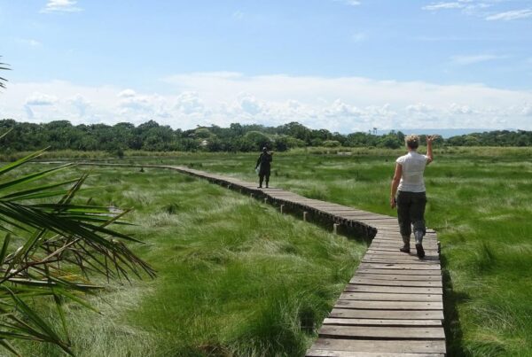
Budongo Forest Hiking: 5-Day Itinerary on a Budget

Adventure Without Breaking the Bank

For travelers seeking a balance between adventure, nature, and affordability, Budongo Forest in Uganda offers an experience that is both immersive and cost-effective. Renowned for its lush tropical canopy, diverse wildlife, and chimpanzee population, Budongo Forest provides hiking opportunities that cater to budget-conscious explorers without compromising on the richness of the journey.

This five-day itinerary has been designed to provide a structured, accessible, and deeply engaging adventure. Every day combines physical activity with wildlife observation, cultural immersion, and practical budgeting strategies. From forest trails to local community interactions, travelers are guided through an experience where natural beauty, exploration, and cost efficiency coexist. Hiking in Budongo Forest is not just a journey through greenery—it is a carefully curated opportunity to engage with Uganda’s biodiversity while maintaining financial prudence.

Why Budongo Forest is Ideal for Budget Travelers

Budongo Forest, part of the greater Murchison-Semliki landscape, is one of East Africa’s largest tropical rainforests. Its accessibility from major Ugandan towns such as Masindi makes it feasible for budget travelers who wish to minimize travel expenses. Unlike commercialized safari destinations, the forest offers affordable entry fees, locally guided hikes, and the opportunity to experience nature intimately without the need for high-cost accommodations.

Hiking trails vary in difficulty, accommodating beginners, intermediates, and experienced hikers alike. Gentle paths along streams and open clearings provide manageable routes, while denser forest sections introduce mild challenges for those seeking a more active experience. Wildlife is abundant, including chimpanzees, monkeys, duikers, and a wide variety of bird species. Observing these creatures in their natural habitat is made possible through guided hikes that are both safe and educational.

Local communities surrounding the forest provide additional cost-effective engagement. Markets, craft villages, and small-scale cultural experiences allow travelers to connect with the local way of life without incurring high expenses. This combination of natural and cultural immersion ensures that the journey is rewarding, memorable, and economically sustainable.

Day 1: Arrival and Initial Forest Exploration

The first day begins with arrival at budget-friendly accommodations near Budongo Forest. Simple lodges, guesthouses, and campsites provide the essentials for a comfortable stay while prioritizing proximity to trailheads and forest entrances. Upon arrival, travelers are briefed on the forest, safety measures, and the five-day itinerary, ensuring that expectations, route plans, and budget considerations are clear.

An afternoon hike along accessible trails allows for gentle introduction to the forest. The sights and sounds of tropical birds, rustling leaves, and playful monkeys create an immediate sense of immersion. Breaks are taken at shaded spots to observe wildlife and reflect on the surrounding landscape. The first evening may include a modest dinner prepared from locally sourced ingredients, providing sustenance while maintaining budget awareness.

This day serves as both orientation and acclimatization, allowing travelers to adjust to the forest environment, practice basic hiking techniques, and prepare for the more intensive exploration that follows. Photography enthusiasts may take advantage of natural lighting during the late afternoon, capturing the interplay of sunlight and foliage.

Day 2: Chimpanzee Trekking and Wildlife Observation

Day two is dedicated to chimpanzee trekking, one of Budongo Forest’s primary attractions. Guided treks are organized at affordable rates, ensuring that even budget travelers can experience this iconic wildlife encounter. Early morning departures maximize the chances of observing chimpanzees while providing the added benefit of cooler hiking conditions.

The trail begins with gentle slopes and gradually ascends through denser forest sections. Travelers are encouraged to move quietly and follow the guidance of experienced forest rangers, as the presence of humans can disturb wildlife. Along the way, other species such as red-tailed monkeys, black-and-white colobus monkeys, and duikers are frequently observed, offering additional opportunities for wildlife appreciation.

Breaks are taken at scenic points where small streams or forest clearings allow hikers to rest, hydrate, and document the experience through photography. Guides provide contextual information about chimpanzee behavior, forest ecology, and conservation efforts, enriching the experience and providing a deeper understanding of the environment.

By afternoon, hikers return to their accommodations for a simple, budget-conscious meal. The evening is reserved for reflection, wildlife journaling, or reviewing photographs. Day two establishes the forest’s rhythm and highlights the value of guided trekking in maximizing both safety and engagement while minimizing costs.

Day 3: Intermediate Trails and Forest Education

On the third day, attention shifts to intermediate-level trails designed to challenge fitness without overexertion. These trails traverse areas with thicker vegetation, mild inclines, and varied terrain, providing a more immersive encounter with Budongo Forest’s ecosystems. Travelers are guided through sections where unique tree species, epiphytes, and wildflowers flourish, creating both visual interest and educational opportunities.

Forest guides facilitate learning by pointing out medicinal plants, explaining ecological interactions, and demonstrating tracking techniques. Children and adults alike benefit from these explanations, deepening understanding of forest dynamics and fostering appreciation for conservation. Occasional wildlife sightings, including monkeys and small antelope, punctuate the hike, providing both excitement and the opportunity for low-cost, memorable encounters with nature.Budongo Forest Hiking: 5-Day Itinerary on a budget

Afternoon breaks are spent near forest streams or clearings, allowing hikers to relax, refresh, and engage in light activities such as sketching or photography. Budget-conscious travelers are advised to carry packed lunches sourced locally, minimizing expenses while ensuring energy levels for continued exploration. Evening reflections and communal discussions about the day’s observations consolidate knowledge and foster shared appreciation of the forest.

Day 4: Cultural Interaction and Community Trails

Day four incorporates cultural interaction, highlighting the lives of local communities surrounding Budongo Forest. Early morning hikes are followed by visits to nearby villages, where travelers may observe traditional crafts, local agriculture, and daily routines. Participation is encouraged at a respectful and budget-friendly level, allowing travelers to engage with local culture without incurring excessive costs.

Guides explain the symbiotic relationship between communities and the forest, emphasizing sustainable practices and the importance of conservation. Children in the villages may perform songs or dances, and travelers may purchase affordable handcrafted souvenirs, ensuring that cultural engagement remains economically feasible.

In the afternoon, easy forest trails are explored, offering a balance between relaxation and physical activity. Streams, small waterfalls, and shaded clearings provide points of rest, wildlife observation, and photography. Evening activities may include storytelling by local guides or communal gatherings at the lodge, reinforcing both education and cultural immersion.

Day 5: Final Exploration and Departure

The final day begins with gentle forest trails that revisit favorite spots and allow for final wildlife observations. Travelers may encounter chimpanzees one last time, observe monkeys or birds, and capture photographs that document their week-long journey. Guides emphasize reflective engagement, encouraging hikers to consider lessons learned, wildlife encounters, and personal growth achieved during the hike.

A farewell gathering at the lodge or camp consolidates experiences, highlights notable wildlife sightings, and provides practical advice for departure. Budget travelers are advised to plan for transportation and meals in advance to avoid unnecessary expenses while ensuring a smooth exit from the forest. Reflection on the week’s adventure reinforces both the value of low-cost exploration and the richness of experiences accessible within a modest budget.

Budget Tips for Hiking in Budongo Forest

Affordable exploration of Budongo Forest requires thoughtful planning. Transportation from major Ugandan towns is best arranged via shared vehicles or local buses. Lodging choices should prioritize proximity to trailheads, family-friendly amenities, and locally run guesthouses that offer competitive rates. Meals sourced from local markets or lodge kitchens reduce costs while providing authentic culinary experiences.

Guided treks, particularly for chimpanzee observation, should be booked directly with park authorities or certified local guides to avoid additional fees from intermediaries. Group hikes can further reduce costs, as shared guides and transport spread expenses across multiple participants. Planning visits during off-peak seasons may also reduce both accommodation and trekking fees, making the forest more accessible to travelers on a strict budget.

Why Budongo Forest Should Be on Every Budget Traveler’s List

Budongo Forest exemplifies how affordable adventure and natural immersion can coexist. Trails of varying difficulty, abundant wildlife, and accessible cultural experiences create a multi-faceted itinerary suitable for all ages and interests. Budget travelers gain access to high-value experiences without compromising on authenticity, comfort, or safety.

The forest’s rich biodiversity, combined with knowledgeable guides and cost-conscious planning, ensures that every hike is both educational and exhilarating. Experiences such as chimpanzee trekking, intermediate-level trails, and community interaction demonstrate that adventure can be both affordable and deeply rewarding.

Affordable Adventure and Lasting Memories

Hiking in Budongo Forest provides a balanced combination of adventure, wildlife observation, and cultural immersion suitable for budget-conscious travelers. This five-day itinerary demonstrates how a week-long journey can be structured to maximize engagement, learning, and personal reflection without exceeding financial limits.

For travelers who wish to explore Uganda’s rainforest, observe iconic wildlife, and engage with local communities while maintaining budget discipline, it is highly recommended to book Africa tours and safaris through WildHorn Africa. With expert guidance, cost-effective itineraries, and a commitment to authentic experiences, WildHorn Africa ensures that every hike, discovery, and moment in Budongo Forest is both memorable and affordable.

Photo Essay for hiking in Lakes George and Edward for luxury travelers

Photo Essay for hiking in Lakes George and Edward for luxury travelers

By Travel stories and blogs, Uganda travel guides

Photo Essay for Hiking in Lakes George and Edward for Luxury Travelers

Where Luxury Meets Adventure and Art

In the heart of East Africa, nestled between Uganda and the Democratic Republic of Congo, lie two of the region’s most pristine and captivating lakes: Lake George and Lake Edward. For luxury travelers seeking an immersive yet comfortable adventure, hiking along the shores and surrounding highlands of these lakes offers a sensory experience that combines serenity, visual splendor, and wildlife encounters. When paired with a camera, the journey becomes a photo essay, where every frame tells a story of nature, culture, and the refined elegance of exploring Africa in comfort.

Unlike traditional safaris that emphasize vehicles and game drives, hiking along these lakes allows travelers to connect intimately with the landscape. Luxury travelers, in particular, benefit from curated experiences that blend high-end accommodations, guided excursions, and personalized attention with the raw beauty of Uganda’s waterways and wildlife. The combination of hiking and photography transforms the journey into a multi-sensory experience: the soft rustling of reeds, the distant calls of hippos, the reflections of skies upon water, and the subtle interplay of light and shadow across rolling hills all become subjects of observation, reflection, and documentation.

Why Lakes George and Edward Are Ideal for Luxury Hiking

Lakes George and Edward are part of the western rift valley system, a landscape marked by volcanic highlands, swamps, and gently rolling savannahs. The terrain provides opportunities for hikers to explore trails that vary in difficulty and scenery, from gentle lakeside walks to more elevated paths that overlook the sparkling waters below. Luxury travelers are often drawn to these areas because the hikes can be tailored to individual comfort and fitness levels while retaining the sense of authentic adventure.

Both lakes are teeming with wildlife. Hippos, crocodiles, and a variety of water birds dominate the lakes, while surrounding savannahs and forested patches host elephants, buffalo, and smaller antelopes. This biodiversity enriches the photographic narrative, allowing each hike to produce a diverse range of imagery. Luxury travelers are typically accompanied by expert guides who provide insights into both wildlife behavior and optimal photographic opportunities, enhancing the value of the journey beyond mere sightseeing.

The accessibility of these lakes is another factor that enhances the experience. Unlike remote or over-commercialized destinations, Lakes George and Edward offer solitude and privacy, which luxury travelers often seek. Accommodations near the lakes, ranging from upscale lodges to boutique tented camps, allow for a seamless blend of comfort and immersion, ensuring that the hiking experience is complemented by refined hospitality.

Curating the Photo Essay: Framing Nature and Wildlife

The concept of a photo essay while hiking involves more than taking casual snapshots. Each frame is considered carefully, capturing not only the subject but also the mood, context, and narrative. At Lakes George and Edward, every element—from light and shadow to movement and texture—becomes part of the story.

Water, for instance, is a recurring theme. Early mornings often present mist rising from the surface, creating ethereal compositions where reflections mirror the sky and surrounding hills. Luxury travelers can photograph hippos slowly surfacing, birds skimming the water’s edge, and fishermen casting nets into glassy waters, creating a narrative that combines natural behavior with human interaction.

The vegetation along the lakeshore offers additional compositional opportunities. Papyrus reeds, tall grasses, and flowering shrubs provide foreground and background interest, framing wildlife or creating depth in landscape shots. Luxury hikers are advised to carry tripods and lightweight lenses that allow them to capture wide panoramas as well as close-up details, emphasizing both scale and intimacy within the photographic narrative.

Day 1: Arrival and Lakeside Exploration

The first day of a luxury hiking and photography experience begins with arrival at a carefully selected lodge overlooking Lake George. Travelers are typically welcomed with refreshments and briefings that highlight the trails, wildlife, and photographic opportunities that will define the itinerary. Attention to detail ensures that comfort is prioritized without sacrificing the immersive experience of nature.

An afternoon hike along the lakeshore provides the initial opportunities for photography. Gentle slopes, accessible paths, and observation points near reeds and inlets allow hikers to explore without exertion while capturing wildlife in its natural habitat. Hippos, often partially submerged, provide dramatic subjects against the shimmering water. Birds, ranging from colorful kingfishers to stately herons, add dynamism and movement to the compositions. The juxtaposition of still water and lively creatures creates striking imagery that resonates with both visual and emotional impact.

As the sun sets, the sky over Lake George transforms, painting the landscape with warm hues that reflect off the water. Photographers are encouraged to capture these moments, using long exposures and natural reflections to create dramatic, luxury-focused compositions. Evening accommodations provide both relaxation and opportunities for reviewing photographs, discussing compositions, and planning the next day’s hikes for optimal light conditions.

Day 2: Elevated Trails and Panoramic Views

On the second day, hiking shifts toward higher elevations, where trails meander through rolling hills and forested patches above Lake George and toward Lake Edward. Elevated vantage points reveal panoramic vistas that are ideal for capturing the lakes in their entirety, with surrounding hills, villages, and wetlands forming intricate patterns of light and shadow.Photo Essay for hiking in Lakes George and Edward for luxury travelers

Luxury guides provide insights into the best angles for photography, highlighting natural framing, optimal lighting, and potential wildlife sightings. Elephants may be seen moving along the forest edges, while birds soar above valleys. Streams cascading into the lakes, coupled with flowering shrubs and trees, create multi-layered compositions that emphasize texture, depth, and perspective. Photographers are encouraged to vary focal lengths and perspectives, moving between wide-angle shots and detailed close-ups to produce a cohesive photo essay that captures both scale and intimacy.

Hiking at this elevation also provides an opportunity to observe and document human activity. Villages scattered across the hills offer scenes of daily life—women carrying water, children playing along dirt paths, and farmers tending to crops. These encounters introduce narrative depth, reminding luxury travelers that the lakes are not only ecological treasures but also integral to local livelihoods and culture.

Day 3: Immersive Nature Walks and Water Interactions

The third day focuses on more intimate exploration of both lakes’ ecosystems. Trails leading closer to the water’s edge, often guided by local rangers, allow travelers to witness wildlife in action. Hippos are photographed as they graze along riverbanks at dawn, crocodiles bask in sunlit stretches, and birds swoop over the lake in synchronized flocks. Photographers are advised to use telephoto lenses to capture wildlife without intrusion, ensuring safety while maintaining image quality.

Kayaking excursions are sometimes incorporated to provide alternative perspectives. From the water, photographs of the lakes and surrounding hills take on new dimensions, with reflections and ripples adding texture and visual interest. Luxury travelers experience the dual sensation of being on the water while remaining comfortable and supported by professional guides, who handle logistics and safety. These excursions also introduce subtle movement into the photo essay, capturing the interplay between human exploration and natural splendor.

Trails extending into forested patches reveal smaller yet compelling subjects: insects, reptiles, and flowering plants. Macro photography in these zones provides balance to the broader landscape images, creating a comprehensive visual narrative. The combination of wide vistas, wildlife portraits, and detailed shots ensures that the photo essay encapsulates the richness of the lakes’ ecosystems.

Seasonal and Lighting Considerations

Timing is crucial for luxury travelers seeking both hiking comfort and optimal photography conditions. Dry seasons, from December to February and June to September, provide firm trails, stable water levels, and clear visibility for wildlife observation. Rainy seasons, while presenting challenges such as slippery paths, also create lush vegetation, fuller lakes, and atmospheric mist that enhance photographic drama.

Lighting is another critical factor. Early morning provides soft, diffused light, ideal for wildlife and misty landscapes. Late afternoon and golden hour offer warmth, contrast, and long shadows, enhancing the visual richness of hills, lakes, and wetlands. Luxury photographers are encouraged to plan hikes around these windows, ensuring that each shot is maximized for both technical quality and artistic impact.

Combining Hiking with Luxury Accommodations and Experiences

A luxury photo essay experience is defined not only by trails and photographic opportunities but also by comfort, service, and curated experiences. Accommodations near Lakes George and Edward provide upscale amenities such as private decks overlooking water, spa services, and gourmet dining featuring locally sourced ingredients. These comforts allow travelers to rest, review images, and prepare for subsequent hikes without compromising the immersion in nature.

Additionally, cultural excursions can be integrated. Visits to local communities, guided storytelling sessions about regional history, and participation in traditional activities provide additional photographic subjects and enrich the narrative of the photo essay. The combination of outdoor adventure, wildlife encounters, and cultural engagement ensures that the luxury traveler experiences both the tangible and intangible beauty of the region.

Ethical and Responsible Photography

Luxury travelers are encouraged to adhere to principles of ethical photography. Wildlife should be observed from safe distances, with minimal disturbance to natural behaviors. Local communities should be approached respectfully, with consent sought before photographing individuals. Trails should be used responsibly, avoiding damage to vegetation and respecting conservation efforts.

These practices not only protect the ecosystems and communities but also enhance the authenticity of the photo essay. Images captured with respect and mindfulness convey depth, sincerity, and an ethical awareness that resonates with viewers and enriches the luxury travel experience.

Crafting a Timeless Photo Essay

Hiking along Lakes George and Edward provides more than physical activity or scenic observation—it offers a luxury experience where adventure, comfort, and artistry converge. For photographers, the combination of wildlife, landscapes, and cultural encounters creates a rich visual narrative that can be captured over multiple days of carefully planned hikes.

The trails, vistas, and waterways provide subjects that range from the grandiose to the intimate, while the integration of upscale accommodations ensures that travelers remain comfortable and supported. Every sunrise, every reflective lake surface, every glimpse of wildlife contributes to a story that is both personal and universally captivating.

For travelers seeking to transform their hiking excursions into a curated photo essay of Uganda’s natural and cultural beauty, it is highly recommended to book Africa tours and safaris through WildHorn Africa. With expertise in luxury travel, photography-focused itineraries, and immersive experiences, WildHorn Africa ensures that each journey is not only memorable but captured with elegance, artistry, and professional guidance.

Semuliki National Park Hiking: Best Time to Visit for honeymooners

Semuliki National Park Hiking: Best Time to Visit for honeymooners

By Travel stories and blogs, Adventure holidays, Travel guides, Uganda travel guides

Semuliki National Park Hiking: Best Time to Visit for Honeymooners

A Hidden Paradise for Love and Adventure

Deep within the folds of western Uganda lies Semuliki National Park, a sanctuary where the wild heart of Africa beats in perfect rhythm with serenity and romance. Known as the “True Birders’ Haven,” this park is far more than just a destination for wildlife enthusiasts; it is also a secret paradise where love finds its place among towering forests, bubbling hot springs, and untouched trails that invite couples to walk hand in hand. For honeymooners searching for an experience beyond the ordinary—a blend of passion, discovery, and tranquil intimacy—Semuliki National Park hiking promises memories that will linger for a lifetime.

Unlike the commonly crowded safari spots, Semuliki exudes a rare charm of exclusivity. Here, couples are greeted not by hurried footsteps of tourists but by the soothing songs of over 400 bird species, the whispering leaves of Ituri Forest, and the distant roar of waterfalls hidden in the wilderness. A honeymoon spent hiking in this park does not only offer breathtaking adventure; it embodies the beginning of a shared life journey where every trail mirrors the path a couple is about to walk together.

The timing of such an extraordinary escape plays a crucial role. Knowing the best time to visit Semuliki National Park for honeymooners ensures that romance blossoms in harmony with nature’s rhythm, making the trip as perfect as the love it celebrates.

Location of Semuliki National Park

Situated in the Bundibugyo District of western Uganda, Semuliki National Park occupies an alluring position along the Albertine Rift Valley. Its borders touch the Democratic Republic of Congo, with the Semuliki River winding lazily along the frontier, acting as a natural boundary. Covering an area of approximately 220 square kilometers, this park holds the distinction of being one of Uganda’s most biologically diverse reserves.

Unlike other parks located on vast savannah plains, Semuliki is deeply forested, extending from the great Ituri Forest of Congo into Uganda. This positioning makes it a transition zone where Central African rainforest meets East African grassland, resulting in unmatched biodiversity. For honeymooners, this unique ecological setting means every step during a hike introduces different shades of beauty—dense vegetation, open clearings, swampy stretches, and riverine landscapes—all combining to create a backdrop of romance and exploration.

Getting to Semuliki National Park

The journey to Semuliki National Park itself can become part of the honeymoon adventure. Couples traveling from Kampala, Uganda’s capital, may embark on a road trip that spans about six to seven hours, covering nearly 360 kilometers. This drive passes through the rolling hills of Fort Portal, a town famed for its lush tea plantations and breathtaking crater lakes. The scenic route offers perfect opportunities for honeymoon photography, with every turn presenting a picturesque view that symbolizes the beauty of shared beginnings.

Alternatively, access to the park can be made easier through domestic flights from Entebbe International Airport or Kajjansi Airfield to Kasese Airstrip, followed by a road transfer to Bundibugyo. For honeymooners seeking comfort and less travel fatigue, the flight option saves time while still granting them the magic of Uganda’s landscapes from above.

The Romance of Hiking in Semuliki

Hiking in Semuliki National Park is more than a physical activity; it is an intimate connection with nature’s soul. Honeymooners walking hand in hand under the towering canopy of the Ituri Forest extension discover how stillness and adventure can coexist. The trails, though sometimes demanding, bring about a quiet rhythm that allows couples to talk, reflect, and share dreams while immersed in nature’s healing calm.

There are several trails within the park, each designed to unveil unique wonders. The most iconic among them is the Sempaya Hot Springs trail, which leads to the famous male and female hot springs, locally referred to as “Bintente” and “Nyasimbi.” Watching steam rise into the air while surrounded by dense greenery creates a surreal, almost mystical atmosphere. Couples often pause here, not just for admiration, but also to symbolically celebrate the warmth of their new union.

For couples seeking deeper immersion, the Kirumia Trail, stretching up to 13 kilometers, offers a full-day adventure leading toward the Semuliki River. It is a haven for birdwatchers, with sightings of rare species like the hornbills and the African piculet. Walking this trail together demands teamwork, patience, and encouragement—values that reflect the foundation of married life.

Attractions That Add Magic to Honeymoon Hiking

Semuliki National Park Hiking: Best Time to Visit for honeymooners

Honeymooners hiking in Semuliki encounter a wealth of attractions that turn ordinary moments into cherished memories. The Sempaya Hot Springs remain the most celebrated, bubbling from deep underground in dramatic fashion. The local communities attach spiritual meaning to these springs, making them not only natural wonders but also cultural symbols of fertility and new beginnings—a fitting metaphor for honeymooners.

Beyond the hot springs, the Semuliki River offers an enchanting sight as it meanders through the park’s forested lowlands. Its banks are frequented by hippos and crocodiles, while the surrounding vegetation serves as home to butterflies and birds of stunning variety.

The park’s wildlife, though not as densely concentrated as in Uganda’s savannah reserves, provides exciting encounters. Forest elephants, pygmy antelopes, and several primate species including baboons, chimpanzees, and colobus monkeys add charm to the hikes. For couples, witnessing such wildlife together brings a sense of shared discovery that strengthens emotional bonds.

The Best Time to Visit for Honeymooners

Determining the best time to visit Semuliki National Park for honeymooners requires understanding the park’s climate, which is predominantly tropical. Rainfall is frequent due to the dense forest ecosystem, but there are still defined dry and wet seasons that affect accessibility and overall experience.

The dry seasons, running from December to February and June to September, provide the most suitable conditions for hiking. Trails are less slippery, rivers are calmer, and the air carries a refreshing crispness that makes long walks more enjoyable. For honeymooners, these months guarantee comfort, safety, and opportunities to fully indulge in romantic experiences without weather interruptions.

The wet seasons, spanning March to May and October to November, transform the park into a lush paradise, though with heavier challenges. Trails can become muddy and difficult to navigate, yet the forest thrives with vibrant greenery and heightened wildlife activity. Couples who are adventurous and eager for solitude may still find the rainy season rewarding, but for most honeymooners seeking ease and romance, the dry season remains the perfect choice.

Why the Dry Season is Ideal for Honeymooners

The choice of the dry season extends beyond convenience; it resonates with the symbolic essence of a honeymoon. The clear skies and mild temperatures create the perfect ambiance for outdoor adventures, photography, and evening relaxation. Couples can share picnic moments by the riverside, watch the sun dip beyond the Rwenzori Mountains, and engage in intimate campfire conversations without worrying about unexpected showers.

Furthermore, the reduced presence of mosquitoes during dry months ensures greater comfort and health safety. Accommodation facilities in and around Semuliki thrive during this time, offering honeymoon packages that combine romance with adventure. With cozy lodges nestled within forest clearings, candlelit dinners under the stars, and morning hikes through the misty trails, the dry season ensures every moment is steeped in romance.

Experiences That Enrich a Honeymoon in Semuliki

Beyond hiking, honeymooners in Semuliki National Park can engage in enriching experiences that elevate their journey of love. Cultural encounters with the Batwa pygmies allow couples to immerse themselves in traditions that have been preserved for centuries. Learning dances, listening to folktales, and participating in community life not only broaden cultural understanding but also add layers of meaning to the honeymoon.

The park also offers opportunities for birdwatching safaris, where couples can spot rare species that are otherwise difficult to find elsewhere. The shared thrill of sighting a new bird species creates unforgettable joint triumphs. Evening game drives and boat rides along the river provide further chances for intimate exploration, where the wilderness becomes a private stage for love to unfold.

A Journey of Love and Discovery

A honeymoon in Semuliki National Park, centered around hiking, transforms into a symbolic journey of love and discovery. Every trail represents the challenges and joys of married life. The steep climbs test resilience, the quiet paths nurture communication, and the scenic viewpoints celebrate the beauty of shared victories. The park’s atmosphere allows couples to retreat from the noise of the world, focusing only on each other and the natural wonders surrounding them.Semuliki National Park Hiking: Best Time to Visit for honeymooners

The park’s uniqueness lies in its blend of adventure and intimacy. Unlike popular destinations filled with bustling crowds, Semuliki provides exclusivity that is rare in modern tourism. For honeymooners, this seclusion fosters genuine connection, ensuring that the first chapter of marriage is marked by peace, reflection, and undisturbed romance.

The Perfect Start to Forever

Choosing Semuliki National Park hiking for a honeymoon is not merely about visiting a tourist site; it is about crafting a timeless memory. The park’s location, its unique attractions, and its serene atmosphere make it an unmatched destination for couples seeking something extraordinary. While the beauty of Semuliki shines throughout the year, the dry season months of December to February and June to September remain the ultimate period for honeymooners to explore, celebrate, and fall deeper in love.

Every whispering breeze in the forest, every call of a hornbill, and every step along the winding trails becomes part of a love story that will be retold for years to come. Semuliki offers not just adventure but also the tranquility needed for newlyweds to reflect on the path ahead. It is where nature and romance merge seamlessly, setting the perfect tone for the rest of life’s journey.

For couples ready to turn their honeymoon dream into reality, the experience becomes even more memorable when planned with the guidance of seasoned experts. To ensure every moment is well curated and stress-free, it is highly recommended to book your Africa tours and safaris through WildHorn Africa, a trusted partner in crafting unforgettable journeys that capture both adventure and intimacy.

The-Complete-Guide-hiking-at-Arua-for-photographers

The Complete Guide: hiking at Arua for photographers

By Travel stories and blogs, Adventure holidays, Travel guides, Uganda travel guides

The Complete Guide: Hiking at Arua for Photographers

Where the Lens Meets the Landscape

In the northwestern corner of Uganda, where culture blends with untamed landscapes, Arua emerges as an uncharted paradise for photographers seeking hiking adventures. Known for its vibrant energy, sweeping savannahs, and culturally rich communities, Arua offers far more than just a passing stopover. For those who carry a camera and an adventurous spirit, it provides a destination where each step on a trail becomes an opportunity to capture textures, colors, and stories that cannot be recreated elsewhere.

Hiking in Arua is not only a physical journey but also a visual exploration. The region unfolds with undulating hills, open skies, hidden villages, and ecological diversity that invite photographers to frame both the grandeur of the land and the intimate details of daily life. Every path feels like a living canvas, and with the right perspective, photographs captured here transform into timeless narratives of Uganda’s northwestern beauty.

Why Arua Appeals to Photographers

The appeal of Arua lies in its ability to merge wilderness and culture. For photographers, the landscapes provide a natural backdrop that is both raw and captivating. The trails, often used by locals for daily movement, reveal hidden pockets of nature where birdlife thrives and traditional homesteads blend into the scenery. Unlike more commercial hiking destinations, Arua retains an untouched quality, allowing images to reflect authenticity rather than curated experiences.

Photographers find themselves immersed not only in the physical beauty of the environment but also in the rhythm of life that unfolds within it. Sunrises cast golden hues across rolling hills, while evenings are marked by vibrant skies fading into soft purples and blues. Such atmospheric shifts present endless opportunities for experimenting with light, shadows, and natural contrasts. In Arua, the story of the land becomes inseparable from the stories of its people, making each hike a layered narrative waiting to be captured through the lens.

Preparing for the Hiking Experience

Arua demands readiness from those who venture into its landscapes. For photographers, preparation extends beyond physical fitness to ensuring that equipment and creative vision align with the environment’s demands. Hikes often involve uneven terrain, moderate climbs, and stretches of open exposure to the sun, meaning that stamina plays as much of a role as technical skill.

Photography gear becomes a critical companion on these trails. Wide-angle lenses capture sweeping horizons, while telephoto options allow detailed framing of wildlife and cultural subjects. Lightweight tripods, protective gear for sudden weather changes, and sufficient storage space for images ensure that no moment is missed. Beyond equipment, patience is required, for Arua reveals its treasures gradually, rewarding those who linger long enough to notice small details—a child’s laughter echoing through a valley, a heron gliding across a wetland, or the textured patterns of traditional architecture.

The Hiking Trails of Arua

The trails in Arua are diverse, offering different perspectives on the region’s ecological and cultural wealth. Some routes lead across rolling savannahs dotted with acacia, where birdwatching opportunities abound. Others wind through hilly terrain that demands endurance but rewards hikers with panoramic views stretching into the distance. Along these trails, photographers encounter contrasts between wilderness and settlement, where fields of cassava or sorghum meet untamed grasslands.

The surrounding environment encourages photographers to frame both broad landscapes and intimate human interactions. Herds of cattle moving gracefully across open fields create striking images of harmony between humans and nature. Meanwhile, vibrant local markets along the outskirts of town introduce splashes of color, energy, and cultural richness that demand to be captured. Each trail feels distinct, yet they all converge on a central theme: Arua as a place where natural beauty and human resilience co-exist in balance.

Capturing Wildlife and Natural Details

For birding enthusiasts with cameras, Arua offers subtle yet rewarding experiences. Wetland patches, wooded areas, and riverine habitats support species ranging from kingfishers to egrets, each presenting opportunities for dynamic compositions. While the region may not boast the density of wildlife seen in Uganda’s major national parks, its quieter landscapes provide intimate encounters that feel more personal and authentic.

Photographers focusing on natural details also find endless inspiration in the textures of Arua. The rough bark of an old tree, the intricate lines of a leaf under the morning sun, and the ripples of water disturbed by a passing bird all offer opportunities for creative expression. Hiking here allows one to slow down, shifting perspective from grand vistas to the micro-worlds often overlooked. Through such details, the richness of Arua emerges in its subtleties as much as in its panoramas.

Intertwining Culture with Hiking

No hike in Arua is complete without encountering the cultural vibrancy of the region. Trails often pass near villages where daily life unfolds against scenic backdrops. For photographers, this provides an invaluable chance to document traditions, attire, and interactions that define the identity of the region. Respect and sensitivity are crucial when capturing such images, ensuring that subjects are portrayed with dignity and authenticity.

Markets become a favorite destination for many hikers with cameras. The colors of fresh produce, the movement of traders, and the hum of conversations create dynamic photographic opportunities. These human-centered scenes add depth to the photographic portfolio, ensuring that the narrative of Arua is not limited to its landscapes alone. Here, hiking transforms into a cultural exploration, reinforcing the idea that adventure is found as much in human connection as in natural scenery.

Timing and Lighting for Photographers

For photographers, timing defines the success of a hiking expedition. In Arua, mornings and evenings are particularly rewarding, with soft natural light enhancing both landscapes and portraits. The golden hour before sunrise paints the hills with warmth, while the fading light at dusk creates dramatic silhouettes and skies alive with color. Midday hiking remains valuable for documenting activity in markets or capturing the stark contrasts of bright sunlight, though care must be taken to manage exposure effectively.

Seasonal variations also play a role in shaping the photographic experience. During the rainy season, the landscapes take on a lush, green vibrancy, while dry periods highlight the earthy tones of savannahs and hills. Each season offers its own visual vocabulary, ensuring that no two hikes ever appear identical through the lens. For photographers, this variation provides ample reason to return to Arua at different times of year, each visit uncovering fresh perspectives.

Safety and Practical Considerations

Safety remains an integral aspect of hiking in Arua. Trails should be approached with proper footwear, hydration, and awareness of weather conditions. Photographers often carry additional equipment, making it essential to balance creativity with practicality. Protecting gear from dust, rain, and accidental damage is critical, as conditions can shift unexpectedly in northern Uganda.

Guides are invaluable companions on these hikes, providing both safety and insight. Their knowledge of routes, local communities, and wildlife enriches the experience, while their presence ensures that photographers can focus on their craft without unnecessary concerns. Respect for local customs and the environment must remain central, ensuring that each step taken contributes to a sustainable and harmonious relationship with the region.

Hiking as a Visual and Emotional Journey

Hiking in Arua offers more than physical exertion; it provides an opportunity for photographers to step into a space where landscapes, wildlife, and culture converge into a unified experience. Each trail reveals new layers of beauty, from sweeping horizons to intimate details, from vibrant markets to quiet encounters with nature. For photographers, Arua becomes a gallery of living moments, waiting to be framed, remembered, and shared.

This journey is not defined solely by the images captured but by the immersion into a land that rewards attentiveness and patience. It is an experience that combines the art of seeing with the discipline of hiking, reminding travelers that the best photographs are often born of authentic encounters.

For those seeking to transform their hiking adventures in Arua into seamless and unforgettable journeys, it is highly recommended to book Africa tours and safaris via WildHorn Africa, where expertise, local connections, and carefully curated itineraries ensure that every step on the trail becomes both safe and profoundly rewarding.

Close Menu